Michelle Menting

A Frame of Air

May 03, 2017

Photo courtesy Michael Gaida
Introduction by Ted Kooser: Once the carpenter put the sash-weights into the wall next to the window, they were never seen again. Eventually they fell off the ropes and with just one loud outcry fell deeper into the dark. But we propped the windows open with this and that, and forgot about the weights. Here's a poem about those props by Michelle Menting, who lives in Maine, and who was once our assistant at American Life in Poetry. Her forthcoming book is Leaves Surface Like Skin from Dancing Girl Press.

Objects Used to Prop Open a Window

Dog bone, stapler,
cribbage board, garlic press
   because this window is loose—lacks
suction, lacks grip.

Bungee cord, bootstrap,
dog leash, leather belt
   because this window had sash cords.
They frayed. They broke.

Feather duster, thatch of straw, empty
bottle of Elmer's glue
   because this window is loud—its hinges clack
open, clack shut.

Stuffed bear, baby blanket,
single crib newel
   because this window is split. It's dividing
in two.

Velvet moss, sagebrush,
willow branch, robin's wing
   because this window, it's pane-less. It's only
a frame of air.

American Life in Poetry is made possible by The Poetry Foundation (www.poetryfoundation.org), publisher of Poetry magazine. It is also supported by the Department of English at the University of Nebraska, Lincoln. Poem copyright ©2013 by Michelle Menting, “Objects Used to Prop Open a Window,” from Decomp Magazine, (February, 2015). Poem reprinted by permission of Michelle Menting and the publisher. Introduction copyright ©2017 by The Poetry Foundation. The introduction’s author, Ted Kooser, served as United States Poet Laureate Consultant in Poetry to the Library of Congress from 2004-2006. We do not accept unsolicited manuscripts.

Arizona

Pictures of Rocks--the Meander Continues

May 01, 2017


Third and final installment of road trip adventures (see part one here, and part two here).

In addition to the striking scenery, good food, and precious hours spent with a friend, one of the best things about my recent trip was the complete break in routine. Routines can become ruts, where life sort of runs on automatic pilot and I don’t think about what I’m doing. After coming home, I have the choice of picking up my previous routines… or not. That’s one of the things I’m still figuring out, two weeks into my return. I feel like I need to change up how I operate.

But I digress.

Before I continue with the travelogue, I have to share with you the Best. Breakfast. Ever.  We ate at Crema in Cottonwood, Arizona both mornings we were in town. If you’re in the area, do not miss it. (No affiliation.)

Crepes with fresh berries and marscapone cheese

Egg sandwich with arugula and sriracha aioli


After fueling up at Crema, we waddled to our car where we took off for further exploration, including: 

The cliff dwellings at Montezuma Castle were home to the Southern Sinagua, and were occupied until the 1400s. Montezuma Castle is one of the best-preserved historic structures of the Southwest. It rises 100 feet above the valley, and consists of five stories and 20 rooms. Early American settlers assumed it was Aztec in origin, so they named it after Montezuma. We walked an easy paved loop trail past the cliff dwellings, down to the river, and back to the visitor’s center.


After the Castle, we stopped by Montezuma Well right at the end of the day, and what a lovely spot it turned out to be! The Well is fed by springs, and more than 1.5 million gallons of water flow into it every day.  The water eventually flows into an irrigation ditch, which has sections that date back over 1,000 years. The Southern Sinagua used water from this well to irrigate crops, and the residents of Rimrock, Arizona currently use it for gardens and livestock. There’s a pretty stiff climb up a hill that leads you to this:


We also climbed down to the water level of the well, and followed a trail along where the water flows out of it. 

In a previous post, I promised striking rock formations, and here they are:


Bell Rock and Courthouse Butte, near Sedona, Arizona. We stopped here briefly before sunset, dinner, and heading back to our hotel for the night.

The last place I’ll take you on this road trip is also one of my favorites: Horseshoe Bend. Horseshoe Bend is near the Grand Canyon, but not technically part of it. You can take an aerial or land tour, but you can also park and walk to the rim for free. Once there, look down 1,000 feet to the Colorado River as it winds around a 270-degree, horseshoe-shaped bend. This is known as an entrenched meander. Isn’t that a wonderful name?


We visited Horseshoe Bend twice, hoping for some good sunset photos, but it was too hazy each time. That didn’t matter—with or without sunset, Horseshoe Bend is photogenic, and the people watching was also entertaining. Stressed-out parents trying to keep their kids safe but still allow them to see and photograph the scene, couples cautiously creeping to the edge of the canyon to take selfies (or foolhardily marching up to the edge), Kerri trying for the perfect shot without losing her camera and tripod into the abyss. Once I snapped my photos, I sat and soaked up the scene while she experimented with settings and tripod placement, letting my eyes wander over the landscape, feeling the slight breeze on my face.

Scenery around Horseshoe Bend

Yes, we were this close to the edge
I hope you’ve enjoyed our little jaunt into Arizona and New Mexico. It’s not always a pleasure to hear about someone else’s adventures when what you really want is to have your own! (Fair warning: there will probably be at least one future Field Trip Friday post based in the Southwest!)

What is your next adventure?

Everyday adventures

From Petroglyphs to Ice Caves—the Enchanted Meander* Begins

April 24, 2017


Installment two of the great Arizona/New Mexico Road Trip...

Let me tell you a little secret about traveling with my friend Kerri. You’d better be ready to GO. She packs more into a day than almost anyone I know. I’m grateful for this, because I’m a bit of a slug by nature. Each day of our trip was chock full of seeing the sights, driving, talking, eating, listening to music or podcasts, hunting that perfect photo, and exploring anything that caught our interest. Last week, I skipped ahead in our trip to write about Antelope Canyon, but now I’m backtracking to our first day’s adventures: 

Petroglyph National Monument is just outside Albuquerque, New Mexico, and it was our first stop on the trip. After checking in at the visitor’s center for advice on where to go if we didn’t have much time, we settled on Boca Negra Canyon. It was a beautiful morning, with cobalt blue skies and cool temperatures. A few minutes easy walk brought us into an area of tumbled volcanic rock, and the petroglyphs were easily spotted on the dark surfaces. These markings were created by Native Americans and early Spanish settlers approximately 400-700 years ago. This area is considered a sacred landscape by the American Indians, according to the Park Service brochure.


We also caught glimpses of the wildlife of the area—rabbits, quail, lizards, and what might have been ground squirrels or prairie dogs—they were too fast and too far away to tell.


 Our next stop was a roadside attraction we stumbled upon:


Located in a collapsed lava tube, the ice on the floor is approximately 20 feet deep. The deepest ice dates back to 1100 AD. Arctic algae causes the ice’s green tint.


We finished off the day sunset gazing on the way to Cottonwood, Arizona:


Where we stayed at the delightful Iron Horse Inn.


In our next installment, our intrepid travelers discover perhaps the world’s most delicious breakfasts, cliff dwellings, and even more stunning rock formations.

*Kerri dubbed her Facebook photo album for our trip “An Enchanted Meander”—and I’m shamelessly appropriating the name.

Adventure

Where the Wind Lives

April 19, 2017


This is installment one of my 2017 Arizona/New Mexico road trip adventures with my friend Kerri. 

As we bumped down the dirt road to the mouth of the canyon, tour company owner Jackie told us that Navajo culture is matriarchal, and the land we were seeing belonged to her mother. The rocky landscape was her home, the place she felt most comfortable. Just before she dropped us off, her words captured my imagination: “This is where the wind lives.”

Antelope Canyon, near Page, Arizona, is one of the most visited slot canyons in the Southwest. (Slot canyons are narrow, deep canyons carved by water.) Tours go to Upper and Lower Antelope Canyon, as well as a few lesser-known canyons. We chose to visit “Canyon X,” with Taadidiin Tours (no affiliation).

After Jackie dropped us off, we descended into the canyon itself, where we were met by a guide. The sandstone curves, swirls, and corkscrews, carved by wind and water into sinuous shapes. Colors range from pale peach to deep purple, depending on the angle of the sun. 


When the sun shines into the canyon just right, you can see the elusive trademark Antelope Canyon shaft of light. As we walked deeper between the curving walls, we saw our first one. (The guides toss fine sand into the air so it shows up in photos.)


If ever there is a place to look up, look down, look all around, it is here.

Looking up
The guides helped us with our camera settings so we would get the best shots, and though they kept an eye on us, they allowed us to freely explore. It wasn’t mobbed with people the way the Upper and Lower Antelope Canyon tours can be, and we were able to take our time exploring, taking photos, and soaking up the peaceful atmosphere. I was even able to sit quietly and make a quick sketch of a section of the canyon. (The challenge will be mixing watercolor representative of the shades of rock I saw!) 

A few more photos: 

Canyon resident

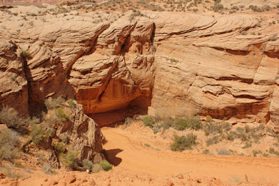
Looking down into the canyon entrance from where we were dropped off.


Canyon X was a magical place, and a not-so-everyday adventure. I highly recommend a visit, and Taadidiin Tours. (See their website, above, or check out their Facebook page here.)